About IFA-101
About IRC
About Joint Secretariat
e-Learning
Annotated IFA
Library Resources
Contact Us
e-Learning
Annotated IFA
Library Resources
About IFA-101
About IRC
About Joint Secretariat
e-Learning
Annotated IFA
Library Resources
Contact Us
Generic selectors
Exact matches only
Search in title
Search in content
Post Type Selectors
Index
Home
»
Annexes
»
Page 4
Annexes
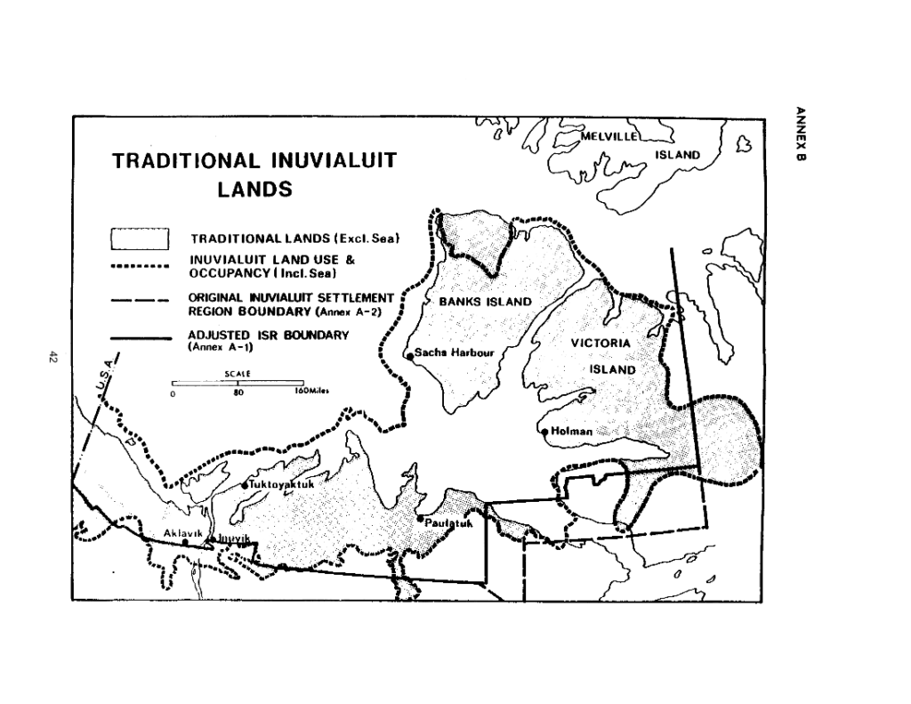
Traditional Inuvialuit Lands (Map)
View on PDF
Inuvialuit lands
Read more