Inuvialuit Settlement Region (map)
Inuvialuit Settlement Region " src="/sites/default/files/annex_a_map.png" style="width: 100%; height: 100%;" />
ANNEX A-1
[Adjusted Boundary]
Description of the Inuvialuit Settlement Region
That region described as follows:
Commencing at the point of intersection between the Yukon Territory/Alaska boundary and the shore of the Beaufort Sea;
thence southerly along said boundary to its intersection with the line of the watershed separating the streams flowing into the Porcupine River from those flowing into the Mackenzie River and the Beaufort Sea, said intersection being at approximate 68°33'25";
ANNEX A-2
[Original Boundary]
Description of the Inuvialuit Settlement Region
That region described as follows:
Commencing at the point of intersection between the Yukon Territory/Alaska boundary and the shore of the Beaufort Sea;
thence southerly along said boundary to its intersection with the line of the watershed separating the streams flowing into the Porcupine River from those flowing into the Mackenzie River and the Beaufort Sea, said intersection being at approximate 68°33'25";
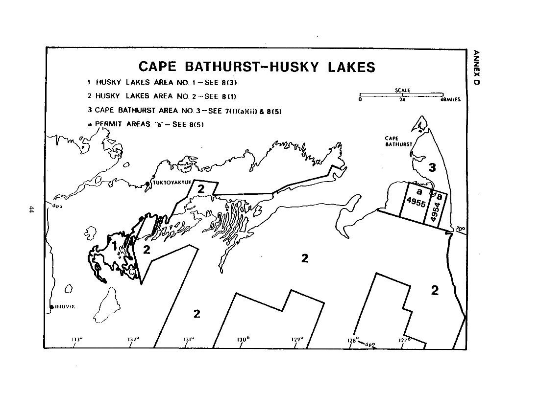
ANNEX D-1
Cape Bathurst 7(1)(a) Land
In the Northwest Territories:
in the District of Mackenzie and the District of Franklin:
ANNEX D-2
Husky Lakes Management Areas
In the Northwest Territories;
in the District of Mackenzie and the District of Franklin:
ANNEX E-1
Registration SOR/80-198 27 March, 1980
Territorial Lands Act
Yukon Placer Mining Act
Prohibition and Withdrawal of Certain Lands from Disposal Order, 1980. No. 1
P.C 1980-679 20 March, 1980
7(1)(a) , 7(1)(b) Land Selection (map)" src="/sites/default/files/annex_f_map.png" style="width: 100%; height: 100%;" />
ANNEX F-1
Aklavik 7(1)(a) Land
In the Northwest Territories;
in the District of Mackenzie:
in the Mackenzie Delta:
All that parcel of land in the Mackenzie Delta according to edition 1 of the National Topographic Series Maps of Aklavik — 107B and Blow River — 117A, produced at a scale of 1:250,000 by the Surveys and Mapping Branch, Department of Energy, Mines and Resources, Ottawa, as said parcel may be more particularly described as follows:
ANNEX F-2
Aklavik 7(1)(b) Land
In the Northwest Territories;
in the District of Mackenzie;
in the Mackenzie Delta;
7(1)(a) . 7(1)(b) Land Selection (map)" src="/sites/default/files/annex_g_map.png" style="width: 100%; height: 100%;" />
ANNEX G-1
Inuvik 7(1)(a) Land
In the Northwest Territories;
in the District of Mackenzie:
in the Mackenzie Delta and Caribou Hills;
All that parcel of land in the Mackenzie Delta and Caribou Hills according to National Topographic Series Maps of Aklavik — 107B. edition 1 and Mackenzie Delta — 107C, edition 2. produced at a scale of 1:250,000 by the Surveys and Mapping Branch of the Department of Energy. Mines and Resources. Ottawa, as said parcel may be more particularly described as follows:
ANNEX G-2
Inuvik 7(1)(b) Land
In the Northwest Territories;
in the District of Mackenzie;
in the Mackenzie Delta;
7(1)(a) Land Selection (map)" src="/sites/default/files/annex_h_map.png" style="width: 100%; height: 100%;" />
ANNEX H-1
Tuktoyaktuk 7(1)(a) Land
In the Northwest Territories;
in the District of Mackenzie;
in the Mackenzie Delta;
All that parcel of land according to edition 1 of the Mackenzie Delta map sheet number 107C of the National Topographic System, produced at a scale of 1:250,000 by the Army Survey Establishment. R.C.E.. at Ottawa, and which may be more particularly described as follows:
Commencing at a point on the southeasterly shoreline of Kittigazuit Bay at latitude 69°20'N and approximate longitude 133°46'W;
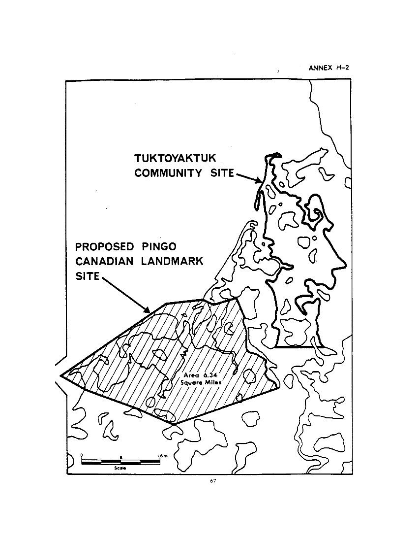
ANNEX H-3
Tuktoyaktuk Community Site
In the Northwest Territories;
in the District of Mackenzie:
in the Mackenzie Delta;